


TerraSond
Precision geospatial solutions

TerraSond delivers innovative, reliable geospatial solutions with a strong company-wide culture in QHSE.
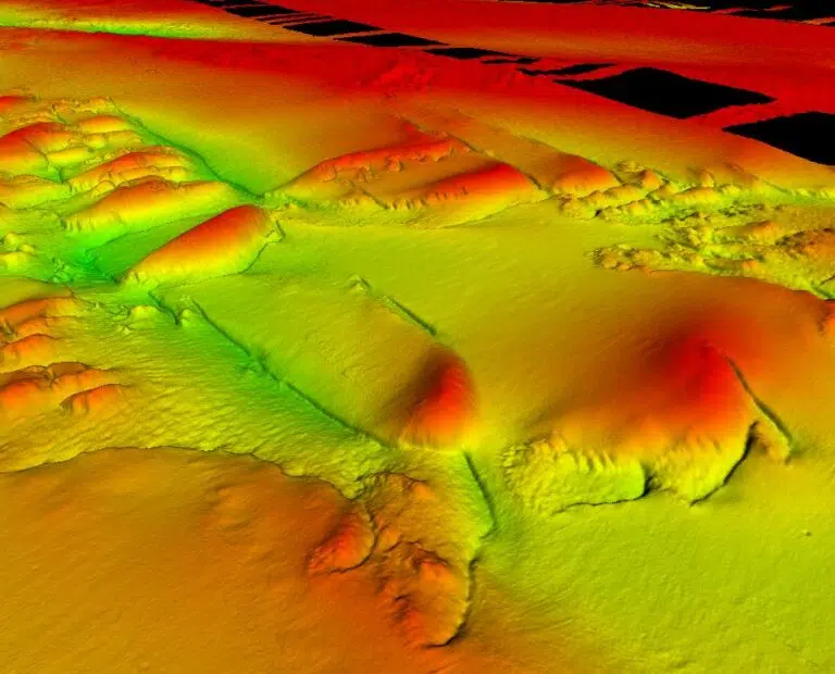
The company has successfully completed thousands of surveys in over 29 countries around the world for over 340 customers. See our extensive track record. These range from inland surveys to deep ocean seabed exploration and mapping projects. The company collects, compiles, and identifies geospatial and geophysical information that provides the best possible solution offering the lowest risk for customers.
Using the latest geophysical and geotechnical techniques, TerraSond’s geosciences supports many industry sectors for offshore pre-engineering designs, site characteristics, and hazard avoidance. Ultimately, the value is a reduction in overall cost in offshore developments for operators with accurate assessments of site characteristics.
TerraSond offers geospatial solutions across a range of energy industries including unexploded ordnance (UXO) identification, subsea structural inspection, marine archaeology, desktop studies, ground models and differentiated high-end imaging to de-risk and optimise projects.
Supporting the energy transition
TerraSond has experience with the cultural, regulatory, and technical issues of power generation and transmission sites. Whether from conventional or renewable sources, TerraSond understands the energies present in the environment and how they can provide both an opportunity and a challenge to harvesting and stabilising those energies. This is key for accurate remediation planning and infrastructure longevity.
Experience and local knowledge in permitting, desk top studies and route planning, offshore cable lay positioning, and bathymetry and morphology data collection is key to the successful completion of projects on time and within budget.
By collaborating early in the planning process, TerraSond can de-risk the unknowns and add value that enables best decisions for best design, placement, and required integrity monitoring of an offshore energy project.
De-risking oil and gas operations
TerraSond plans projects to minimise risk that provides the critical data that customers depend upon to make the right decisions, safely and on-time. Capabilities cover field exploration, field abandonment and production, and decommissioning and abandonment.
Telecommunications support
TerraSond understands the cultural, local regulatory, and technical issues inherent to offshore fiber optic cable route projects. Telecommunications support expertise includes permitting, performing detailed desk top studies, route planning, in-vessel positioning, and seafloor bathymetry and morphology. Value is demonstrated by teaming early in the planning process to de-risk the unknowns, enabling the best decision for correct placement of your fiber optic cable.